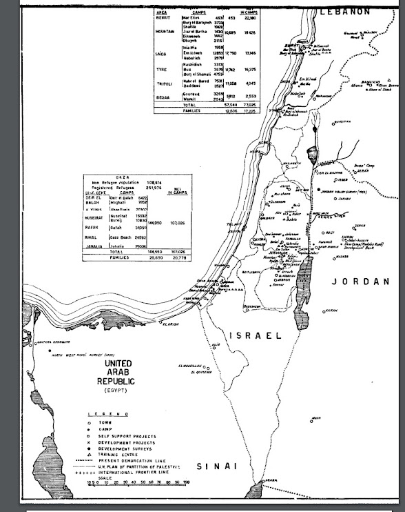
I just found the 1960 annual report of UNRWA which shows maps of its fields of operations.
Look at Israel.
13 years after it was rejected by the Arabs, UNRWA was still drawing the 1947 partition lines on top of the "present demarcation line." The only reason that the partition lines could be relevant is if UNRWA felt that they were the "real" borders of Israel.
So the Green Line was never the "internationally recognized border" of Israel. The 1949-drawn line only became sacred after 1967.
It is one of those magical things that happen in the Middle East, like how "occupied Jordanian lands" turned into "occupied Palestinian lands."


